Lough Neagh Digital Twin

Lough Neagh Digital Twin

Mapping and monitoring the water quality of Northern Ireland's largest freshwater lake using advanced satellite imagery and environmental modelling

Project Overview

+

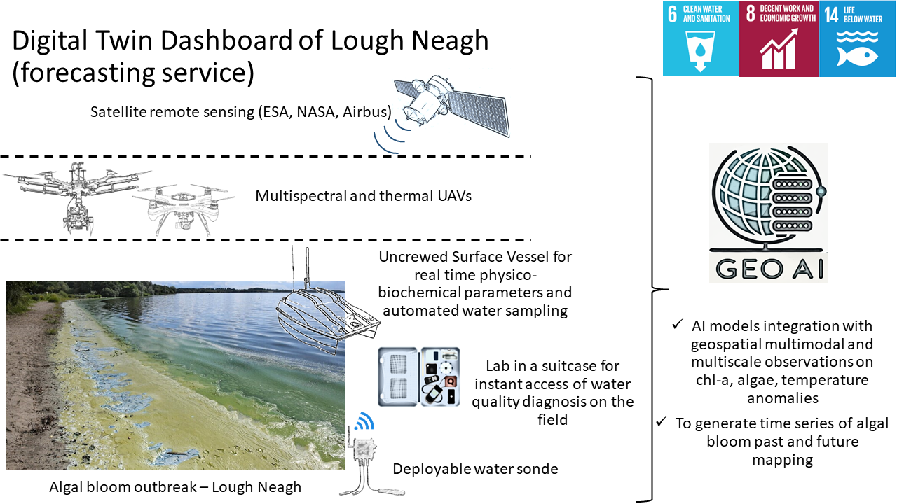
The Lough Neagh Digital Twin project creates a comprehensive virtual model of Northern Ireland's largest freshwater lake, integrating satellite data with ground measurements to monitor water quality, algal blooms, and ecological changes over time.

Lough Neagh Overview

Our digital twin serves as a powerful tool for environmental managers, policymakers, and researchers to understand the complex interactions within this vital ecosystem and address challenges such as eutrophication, pollution, and climate change impacts.

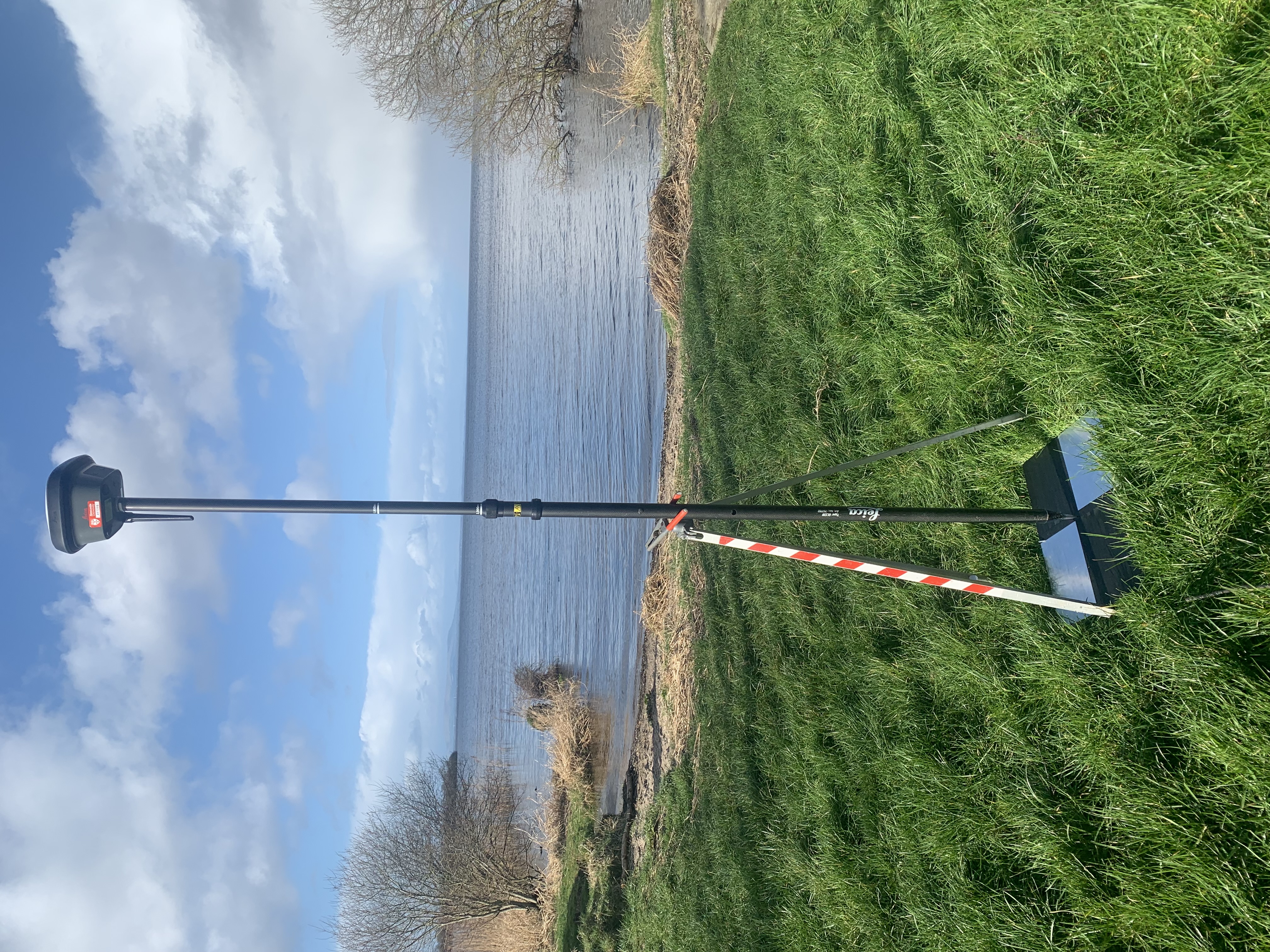
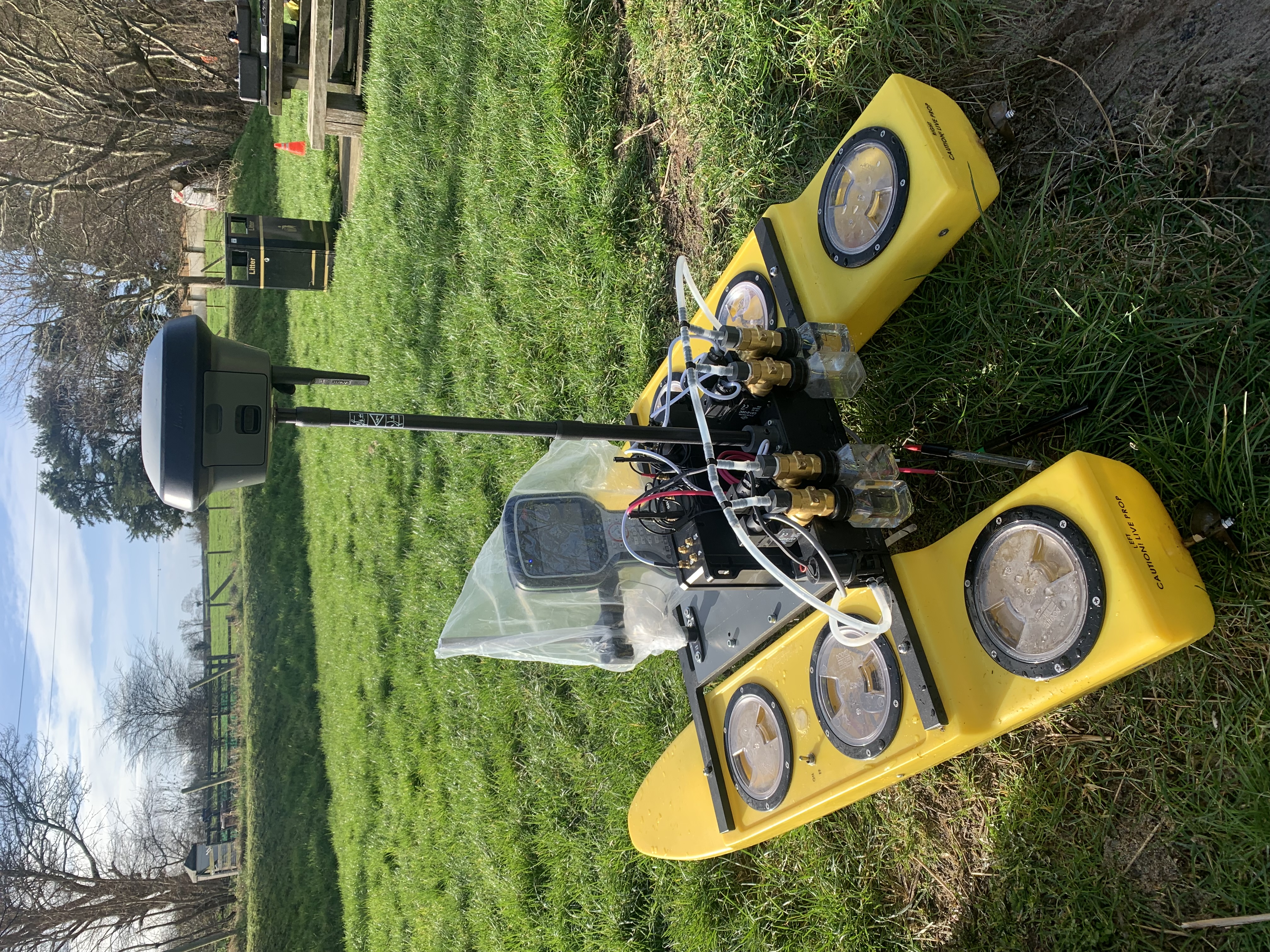
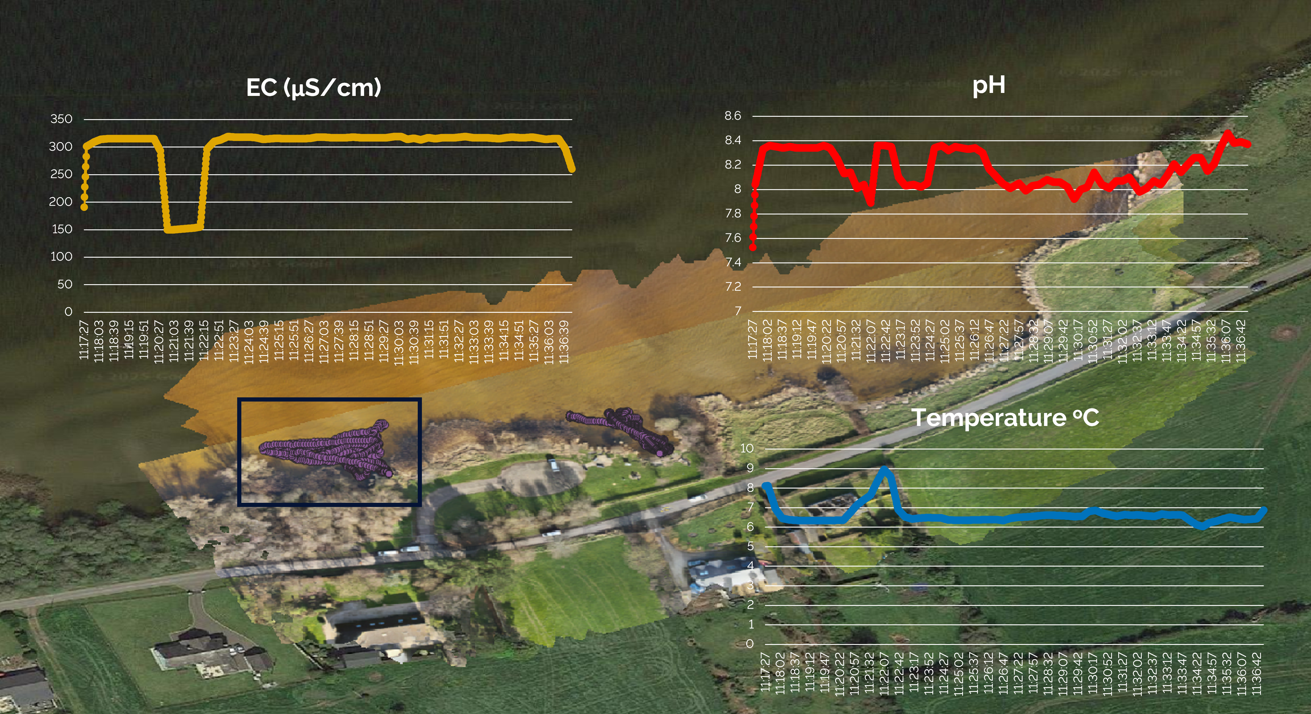
We are currently working to deliver actionable visualisations of forthcoming algal blooms by integrating multiscale terrestrial, airborne, and satellite data applying remote sensing with geo-Artificial Intelligence technologies.

Our proof-of-concept work will ultimately demonstrate how near real-time forecasting can serve as an early warning system for algal blooms using geospatial technology.

This project brings together an interdisciplinary team with diverse expertise in Earth Observation, computer science, geospatial engineering and biogeochemistry at School of Engineering, School of Computing and School of Natural and Environmental Sciences, Newcastle University.

This collaborative effort, backed by NI SPACE, the UK Space Agency, and the Department of Agriculture, Environment and Rural Affairs, demonstrates the potential of space technology to tackle urgent environmental challenges.

Read more at 'Three firms selected for Lough Neagh space project' (BBC News)

Size & Scale

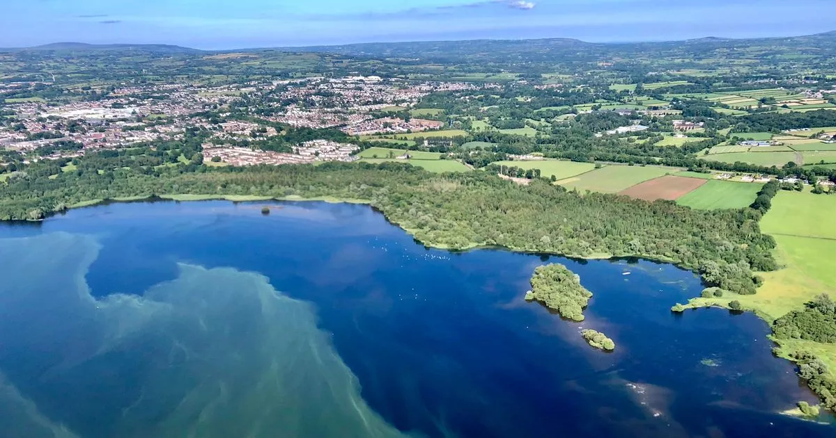
392 km² surface area, making it the largest freshwater lake in the British Isles

Biodiversity

Home to numerous bird species, fish populations, and unique aquatic ecosystems

Water Supply

Provides 40% of Northern Ireland's drinking water

Our Team

+

The Lough Neagh Digital Twin project is led by a diverse team of researchers with expertise in remote sensing, environmental modeling, computer science, and geospatial engineering:

Current Challenges

+

Lough Neagh faces several environmental challenges that our project aims to monitor and address:

  • Blue-Green Algal Blooms: Increasing frequency and severity of harmful algal blooms affecting water quality and ecosystem health
  • Nutrient Pollution: Agricultural runoff and wastewater contributing to eutrophication
  • Climate Change Impacts: Rising water temperatures and changing precipitation patterns affecting lake dynamics
  • Invasive Species: Monitoring the spread and impact of non-native species on the lake ecosystem
  • Sedimentation: Increased erosion from surrounding lands affecting water clarity and lake morphology

Through our digital twin approach, we can identify the drivers of these issues and provide evidence-based recommendations for lake management and policy development.

More information on current challenges and updates on Blue Green Algae in Lough Neagh can be found here: DAERA Blue-Green Algae Update (daera-ni.gov.uk)

Data & Tools

+

Our project utilises various technologies and platforms to collect, process, and analyse data:

  • Satellite providers: Sentinel-2 MSI, Landsat 8/9 OLI, MODIS, PlanetScope, Airbus
  • Field Instruments: Spectroradiometer, water quality probes, unmanned surface vehicle, unmanned aerial vehicle
  • Processing Software: SNAP Toolbox, ACOLITE, custom Python algorithms, Docker, Github
  • GIS Platforms: QGIS for spatial analysis and visualisation

The digital twin will potentially integrate these diverse data streams to create a holistic view of the lake's water quality condition and dynamics, accessible through an interactive web platform for researchers and stakeholders.

Data Collection (February 2025)

+

Fieldwork was conducted in February 2025 at Bartins Bay, southeast of Lough Neagh, collecting multiple geospatial and in-situ observations. During the field campaign, multispectral and thermal imagery was acquired using uncrewed aerial vehicles (UAVs), while spectral measurements were taken with a spectroradiometer at various locations, including areas of clear water and regions with mixed water and aquatic vegetation. In-situ water sampling and real-time water quality analysis were also performed, assessing parameters such as dissolved oxygen, salinity, turbidity, and ammonium concentrations.

GNSS-RTK measurements
Figure 1: GNSS-RTK measurements to survey a ground target for UAV imagery processing Figure 2: Bartins bay as captured from the UAV in February 2025

Additionally, an uncrewed surface vehicle (USV; Figure 3) was deployed to capture water quality parameters using probes for pH, temperature, and electrical conductivity (EC) (Figure 4). Correlations between in-situ spectral and temperature measurements and satellite-derived products from Sentinel-2, PlanetScope, and UAV-based multispectral and thermal imagery have further reinforced the reliability of the methodology.

USV in-house made USV-obtained readings
Figure 3: USV in-house made with geo-located water quality readings. Figure 4: USV-obtained EC, pH and temperature readings while USV is remotely piloted in the water (purple dots) superimposed on UAVs-generated RGB orthomosaics. Google Earth satellite imagery is used as a basemap in the background.

Get Involved

+

There are several ways to engage with the Lough Neagh Digital Twin project:

  • Research Collaboration: We welcome partnerships with academic institutions, environmental agencies, and community organizations
  • Data Sharing: Contribute field measurements, historical records, or local knowledge
  • Student Opportunities: MSc and PhD research positions available in remote sensing, environmental modeling, and water quality analysis

For more information on how to get involved, please contact Dr. Maria-Valasia Peppa at maria-valasia.peppa@newcastle.ac.uk.